National Hurricane Center Watching Two Systems in the Atlantic
Just when you thought it was safe to take an eye off the tropics, here we go again.
Just kidding, we know you are always watching this time of year and so are we. The National Hurricane Center in Miami, Florida is tracking two weather systems as they show potential for development as they travel west across the Atlantic Ocean.
Let's look at both systems independently to size up the next week or so. Storms that have the potential to become tropical events start out as events called an "Invest." It is the name given to an area of unorganized thunderstorms that could become larger tropical events.
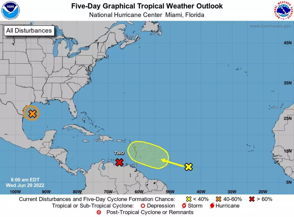
Invest97L is the first of two systems headed west across the Atlantic. Right now it is attempting to develop in the Caribbean Sea before possibly moving into the Gulf of Mexico or up the Eastern coast of the United States. Up until now, this system is a bunch of disorganized thunderstorms moving at about 20mph. This storm is expected to slow down, but models show these storms beginning to spin as they approach the Gulf, making this a potential threat for Texas. Formation through 48 hours is at 20%, but formation through the next 5 days is at 60%. Keep an eye out.
Invest 98L is the second of the two storms packing a punch that makes it more likely than Invest97L to develop into a Tropical Depression or Tropical storm. This storm is a broad area of low pressure about 900 miles west-southwest of Cabo Verde. This system is much more concentrated and is expected to become a Tropical Depression within the next couple of days while heading west-northwest at 15 to 20 mph. Invest98L has a 70% chance of developing into a larger event in the next 48 hours and a 90% for development over the next 5 days. Because of the current path of this system, some models have it hooking north and spinning away from the US. Others show this storms as developing and heading into the Gulf of Mexico. It's too soon to tell, but worth watching!

KEEP READING: What to do after a tornado strikes
More From KIXS FM 108